Project Description:
Forest ecosystems are a crucial part of the Earth’s global carbon cycle, and understanding how forests will respond to future climate change is extremely
important, especially when considering artificial ‘greening’ options to mitigate CO2 emissions. But the relationship between forests and climate is complex –
trees remove CO2 from the atmosphere but they also form soils that influence water-mineral reactions, alter the water cycle and make the Earth’s surface less
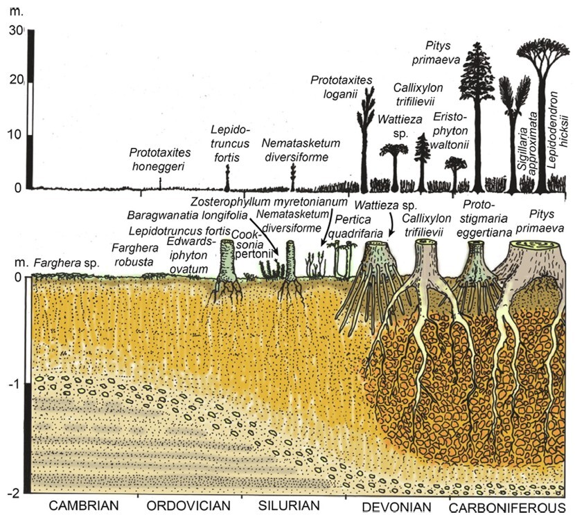
reflective to sunlight. This project seeks to understand these relationships by mapping out the initial expansion of forests during the Devonian period some
400 million years ago, and relating the spread of the first forests to changes in CO2 and climate during this time. In short – we seek to better understand this
ancient ‘greening’ experiment that has already been run at the global scale.
Our group (https://earthevolutionmodelling.com) has recently produced a set of maps of Earth’s ancient land surface and we are working to populate these
with fossil data on the spread of the first forests. The student will
- Compile and normalise Devonian plant fossil data from literature to generate spatial and temporal changes in plant diversity;
- Learn to use the ‘Gplately’ python module to shift the present day plant fossil locations into the palaeo-coordinates of each stage; Plot plant fossil maps
and upscale to global estimates using climate zone information - Estimate total carbon drawdown and compare to known reductions in atmospheric CO2 over this period
Pre-requisites:
N/A
Supervisory Team:
Benjamin Mills:
Contact:
Benjamin Mills: [email protected]