Project Description:
Antarctic glaciers are losing ice rapidly. When large pieces break off as icebergs it is known as calving. Calving events can generate underwater tsunamis that
mix the surrounding ocean and influences glacier stability, global sea level, and marine ecosystems. To study this process, scientists need reliable
measurements of where glacier fronts are and how they change over time.
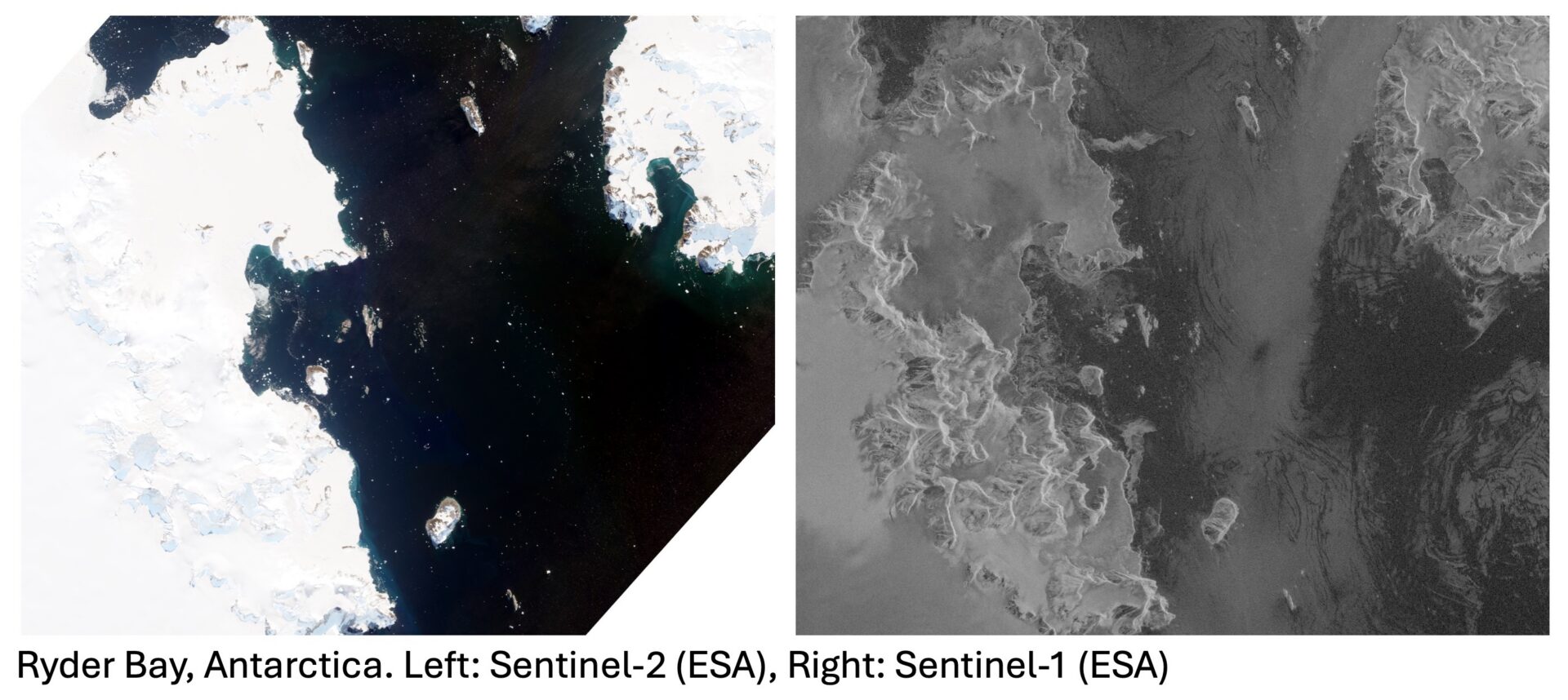
In this project, you will use Synthetic Aperture Radar (SAR) images from ESA’s Sentinel-1 satellite mission to help map the position of glacier calving fronts.
SAR is especially useful in Antarctica because it does not need the Sun’s illumination and can see through cloud. You will apply an existing deep-learning
workflow developed within the Satellite Ice Dynamics (SID) group to an untested region of Antarctica and assess how well it performs there. This work forms a
direct contribution to POLOMINTS, a collaborative project between several international institutions led by the British Antarctic Survey (BAS) investigating
how calving events generate underwater waves and drive ocean mixing.
You will join the SID research group, attend weekly meetings, learn what others in the group are working on, and present brief updates on their own progress.
There may also be an opportunity to present a poster at the International Glaciological Society’s British Branch meeting in Aberdeen in September. The
placement offers a supportive introduction to working with real scientific data and being part of an active research team.
The student will begin by learning how to access and view Sentinel 1 radar images using online tools and GIS software. They will then run a set of pre written
scripts (in Python and Bash) to process the imagery, with guidance provided throughout. The student will compare the SAR imagery with optical data to
understand more about the advantages and disadvantages of both and what calving events look like from space. Once the student is familiar with the data,
they will apply a deep-learning workflow that automatically traces glacier calving fronts, focusing on a region of Antarctica that has not yet been analysed in
previous work.
The main task is to evaluate how well the deep learning performs in this new setting by comparing the automated results to manually drawn calving fronts.
This involves measuring how closely the two sets of positions match and exploring why the method works better in some areas than others. The success will
be measured both manually, using GIS software to measure the distance between delineated fronts at multiple points, and programmatically by writing and
applying code to the imagery. The student will have scope to adjust simple processing parameters to understand how this affects the final output. They will
keep a record of their findings and present a mid placement update and a final summary at a SID group meeting.
Throughout the project, the student will interact regularly with members of the research group, gaining experience of how polar science is carried out in
practice. By the end of the placement, they will have developed skills in satellite data handling, GIS, basic Python for geospatial analysis, and the evaluation of
AI methods. They will also gain experience presenting scientific work and contributing to a larger research programme (POLOMINTS), with results that will be
used by collaborators studying calving driven ocean mixing.
Pre-requisites:
No prior coding or GIS experience is required, although an interest in learning basic programming and working with data will be helpful. The project is
suitable for students from a wide range of disciplines who are curious, enjoy problem solving, and want experience working with satellite data as part of an
active research group.
Supervisory Team:
Jacob Connolly
Contact:
Jacob Connolly: [email protected]