Context-Aware Urban Climate Downscaling with Multi-Scale Geospatial Foundation Models
Background
Our planet is warming, but the most severe impacts of climate change are felt locally within our cities, where most of the global population lives and works. These urban systems are economic powerhouses and hotspots of climate change risk, where impacts like intensified heatwaves and flooding can disrupt economies and threaten public health. To understand and assess these future impacts for informed decision-making, climate projections are essential. However, such projections are typically from global models operating at 100-200 km resolutions, which are far too coarse to “see” critical city-level details.
Climate downscaling, which generates fine-grained climate projections (e.g. at 300m resolution), is a key instrument for detailed impact assessments, e.g. for public health. Recently, machine learning (ML) based solutions for climate downscaling have gained momentum, providing much more efficient and sometimes more realistic simulations than process-based regional climate models. ML-based climate downscaling usually employs computer vision pipelines, akin to generating a high-resolution image from a low-resolution one. Despite substantial advancements, these methods face several prominent limitations:
- Inadequate spatial transferability between different geographical regions.
- Struggle to translate detailed urban patterns like building morphology and street canyons into physically meaningful climatic effects.
- Heavy reliance on extensive fine-grained ground truth data, which is sometimes unavailable.
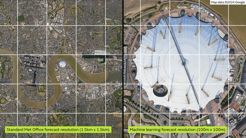

Temperatures across Central/W London from AI model. Figure from Blunn et al. (2024): https://doi.org/10.1002/met.2200.
Methodology
This project will address these challenges by incorporating spatiotemporal contextual knowledge from geospatial foundation models (GeoFMs) into ML-based urban climate downscaling. GeoFMs are models pretrained on large-scale geospatial datasets for numerous downstream geographical analyses. They function like “ChatGPT for Geography” and possess a comprehensive understanding of our Earth across different scales. In this project, we will leverage GeoFMs at three distinct scales:
- Macro-scale: Earth system models (e.g. Aurora) to capture large-scale atmospheric dynamics and thermodynamics.
- Meso-scale: Models like AlphaEarth to provide satellite-derived data on land cover, elevation, gravity fields, and surface properties.
- Micro-scale: Urban models such as CityFM to describe the built environment and its socioeconomic features down to individual buildings and roads.
This PhD project will develop a novel framework to inject knowledge from these multi-scale GeoFMs into advanced generative architectures, such as diffusion models, for urban climate downscaling. By infusing such knowledge, the models will learn which climate patterns occur where, leading to more reliable and realistic results, even in untrained areas or those with inadequate ground truth data. The datasets used for training and testing will include global climate datasets from CMIP6 and local urban-scale climate datasets (300m resolution) produced by the Met Office.
Key outputs and potential for high impact
The fundamental output will be a state-of-the-art urban climate downscaling framework at the frontier of climate science and ML research. During development and testing, detailed city-scale climate projections will be produced at resolutions of 300 metres or finer. The methods and models will be made open source to benefit the public. Downscaled projections for cities like London, Paris, and Singapore will help assess local climate change impacts, inform policymaking, and enrich repositories such as CORDEX.
Training and environment
You will work closely with experts from both the University of Leeds and the Met Office. The supervision team is highly interdisciplinary, with longstanding experience in climate science, machine learning, and urban studies. Particularly, you will work with and regularly visit the AI downscaling group at the Met Office, gaining world-class scientific and practical experience. The main supervisor is an internationally recognised researcher in geospatial foundation models. You will have sufficient computing infrastructure to carry out the research. Through this project, you will build a highly transferable toolset and interdisciplinary network, preparing you for a career in academia, industry, or policymaking.
An envisioned training timeline is as follows:
- Year 1: Establish foundational knowledge of climate downscaling, regional modelling, and GeoFMs; prepare and preprocess most necessary data.
- Year 2: Develop the novel context-aware downscaling model, including prototyping, GeoFM integration, model training, and validation.
- Year 3: Conduct spatial transferability experiments across global cities; generate downscaled (≤300m) climate projections for selected cities under various scenarios.
- Year 4 (6 months): Write the PhD thesis and final papers for publication.
References
[1] Rampal, N., Hobeichi, S., Gibson, P. B., Baño-Medina, J., Abramowitz, G., Beucler, T., … & Gutiérrez, J. M. (2024). Enhancing regional climate downscaling through advances in machine learning. Artificial Intelligence for the Earth Systems, 3(2), 230066.
[2] Kendon, E. J., Addison, H., Doury, A., Somot, S., Watson, P. A., Booth, B. B., … & Scullion, C. (2025). Potential for machine learning emulators to augment regional climate simulations in provision of local climate change information. Bulletin of the American Meteorological Society, 106(6), E1175-E1203.
[3] Janowicz, K., Mai, G., Huang, W., Zhu, R., Lao, N., & Cai, L. (2025). GeoFM: how will geo-foundation models reshape spatial data science and GeoAI?. International Journal of Geographical Information Science, 1-17.
[4] Bodnar, C., Bruinsma, W. P., Lucic, A., Stanley, M., Allen, A., Brandstetter, J., … & Perdikaris, P. (2025). A foundation model for the Earth system. Nature, 1-8.
[5] Brown, C. F., Kazmierski, M. R., Pasquarella, V. J., Rucklidge, W. J., Samsikova, M., Zhang, C., … & Kohli, P. (2025). AlphaEarth Foundations: An embedding field model for accurate and efficient global mapping from sparse label data. arXiv preprint arXiv:2507.22291.
[6] Balsebre, P., Huang, W., Cong, G., & Li, Y. (2024, October). City foundation models for learning general purpose representations from openstreetmap. In Proceedings of the 33rd ACM International Conference on Information and Knowledge Management (pp. 87-97).