The Future of Himalayan Glacial Lakes: Uncovering Subsurface Features and Instabilities with Fieldwork and Remote Sensing Observations

Background
This project will analyse field-based and earth observation data to explore key glacial lake characteristics that can be used to inform glacier evolution and disaster risk reduction strategies.
High mountain environments form river headwaters that sustain billions of people, in addition to offering refuge for biodiversity, hosting shrinking glaciers, and being landscapes of cultural and spiritual value1. However, these landscapes are changing in response to climate change, urbanisation, and infrastructure development, which creates new challenges for sustainable and risk-informed development.
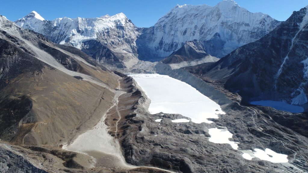
Glacial lakes are forming in place of diminishing glaciers2,3. However, their location in often high-altitude, remote, and logistically challenging environments means that key lake characteristics are poorly understood, including the amount of water stored and the associated hazards1. Glacial lake outburst floods (GLOFs) can cause extensive damage and disruption to livelihoods in countries such as Nepal4 and can also initiate secondary cascading hazards such as landslides. Additionally, glacial lakes contribute to enhanced glacier mass loss through positive feedback mechanisms.
Few glacial lakes have surveyed information of the lakebed geometry, and existing surveys from single beam echo sounder systems can contain large uncertainties. This project will have a unique opportunity to deploy a multibeam system capable of generating a comprehensive, high-resolution model of the lakebed. This will enable quantification of key lake characteristics, including water storage capacity, bed composition, sedimentation rates, and the presence and degradation of stagnant glacier ice. These in-situ observations will be integrated with satellite data to better understand the evolutionary trajectories of glacial lakes in a changing climate.
Aims and objectives and methodology
This project aims to quantify the subsurface characteristics and evolution of high-mountain glacial lakes using novel combinations of earth observation and field data. Objectives can be tailored to the interests and strengths of the researcher:
- Evaluate and streamline current scientific and in-country protocols for quantifying glacial lake characteristics including areal expansion, temperature, bathymetry, and hazard.
- Use novel multibeam bathymetry surveys at glacial lakes to quantify lake geometry, the presence of stagnant glacier ice, geomorphic features, and sedimentation rates.
- Use multi-temporal lake bathymetry as a space-for-time substitution to analyse and improve estimates of glacier ice thickness and lake development trajectories.
- Develop new protocols for detecting hazard-related instabilities by coupling field-based and remote sensing observations, including using Interferometric Synthetic Aperture Radar (InSAR) to detect centimetre level deformation of the lake environment.
The project will use freely available global satellite datasets, including Sentinel-1 (radar), Sentinel-2 (optical), and ICESat-2 (altimetry), in combination with commercial datasets such as PlanetScope. The project could involve fieldwork at high-altitude glacial lakes in Nepal depending on the researcher’s interests.
Training and supervision
The successful candidate will by supervised by an expert team to develop research skills in GIS, earth observation data, fieldwork, deep learning, programming, use of high-performance computing, and data analysis and presentation. The researcher will be encouraged to write papers for publication during the project and to attend conferences to present their results and gain feedback. The researcher will contribute to the Glacial Lake Observatory for Flood Hazards Impacted by Changing Climate (GLO-FHICC) project and will have the opportunity to work with project partners including United Nations Development Programme (UNDP) Nepal, and Nepal Development Research Institute (NDRI). You will also be affiliated with world-leading research centres including water@leeds and the Priestley Centre for Climate Futures.
Entry requirements
A good first degree (1 or high 2i). A masters degree or equivalent in geography/ GIS/ earth sciences/ glaciology/ or related discipline, and experience in computer programming (e.g., R, Python, or MATLAB) and fieldwork skills are desirable.
References
- Quincey, D. et al. The changing water cycle: the need for an integrated assessment of the resilience to changes in water supply in High-Mountain Asia. Wiley Interdiscip. Rev. Water 5, e1258-n/a (2018).
- Shugar, D. H. et al. Rapid worldwide growth of glacial lakes since 1990. Nat Clim Change 10, 939–945 (2020).
- Watson, C. S. et al. Mass Loss From Calving in Himalayan Proglacial Lakes. Front Earth Sci 7, (2020).
- Carrivick, J. L. & Tweed, F. S. A global assessment of the societal impacts of glacier outburst floods. Glob Planet Change 144, 1–16 (2016).
