
YES-27-D-27: Seismology for the Stone Age: Nodal Seismic Imaging of Archaeological Mounds
Project code: YES-27-D-12
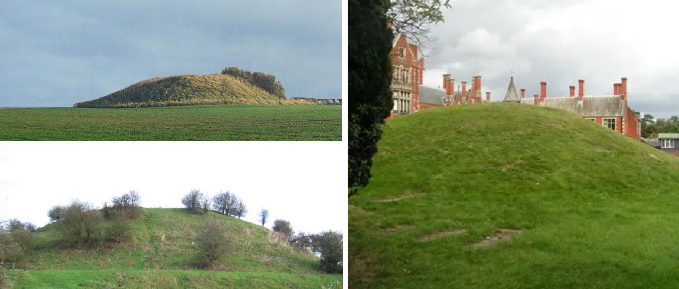
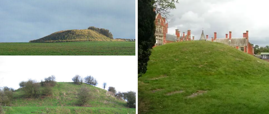
Ancient mounds are common features in the British landscape, however their function – whether as burial sites, ritual monuments or territorial markers – is only ascertained from invasive excavation. Geophysical surveys can explore the internal structure of these mounds, but their complex internal structure can impede the success of high-resolution technologies such as ground-penetrating radar (GPR). However, there is an ever-growing need for non-destructive insight, since any invasive investigation of can disturb the fragile structure of these mounds. When coupled with increased subsurface stresses associated with changing weather patterns, caused by climate heating, preserving the intact structure of archaeological mounds is ever more important.
Seismology has its uses in archaeology, but it tends to be applied for characterising large-scale landscapes – for example, imaging ancient land surfaces and identifying favourable locations for human habitation. This is because active-source seismic wavelets typically lack the resolution to image comparatively small archaeological targets. However, recent developments in the technologies of full waveform inversion and ambient noise seismology offer higher resolution sensitivity, potentially unlocking seismic methods for characterising the internal structure of mound-scale features. This can add support to interpretations made from other geophysical technologies, increasing the depth of subsurface sensitivity and how comprehensively a structure can be characterised. Nonetheless, the application of these technologies requires dense sampling of the seismic wavefield, likely only achievable with the installation of nodal seismic systems.
Geophysics also has advantages for the strategic management of archaeological assets, but seismology can be particularly valuable in assessing their vulnerability to changing weather patterns. Seismic wavelets directly sample the mechanical properties of the subsurface, via elastic quantities such as the bulk and shear modulus. Seasonal changes in these quantities could help inform whether the internal structure of the target remains stable or whether it is vulnerable, for example, to water ingress, cracking, and potential collapse.
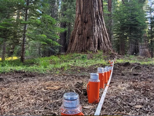
In this project, you will explore the application of nodal seismology approaches for characterising and monitoring UK archaeological structures. By deploying nodal seismic instruments (e.g., Figure 1) available at the University of Leeds and its partners at Birkbeck, University of London, you will assess the degree to which passive- and active-source seismic methods can resolve internal mound structures.
By undertaking comparative studies at different sites, or comparing seasonal signals in recorded data, you will determine the applicability of nodal seismology for archaeological imaging and asset management. Depending on your interests and expertise, you may:
- Integrate observations from other geophysical systems, including GPR and electrical resistivity imaging;
- Develop wavefield reconstruction approaches, via machine learning, that reduce the burden of nodal seismometer deployments;
- Consider the contribution of other seismic acquisition platforms including fibre-optic distributed sensing; and
- Pending necessary permissions from site managers, compare seismic expressions of material strength against the results of geotechnical testing.
Your observations will be grounded within an archaeological context, with expertise contributed by partners at the University of York. Potential study sites include Buckinghamshire’s Taplow Mound and a ‘sister feature’ nearby, Duggleby Howe and Skipsea Castle in Yorkshire, or La Hougue Bie on Jersey.
As a PhD student in the YES Doctoral Training Network, you will benefit from a training environment that offers diverse schemes to boost your skills beyond technical expertise. Such schemes include academic writing to help you prepare the submission of research articles, and presentation skills to give you confidence in disseminating your work to varied audiences. During your studies, you will be based in the Institute of Applied Geoscience (IAG) of Leeds’ School of Earth, Environment and Sustainability, but can access research and researchers across the breadth of its research centres – including a vibrant network of PhD peer support. You will also access specialist support in nodal seismology and archaeology from external supervisors; funds will be available through the project to visit their departments for detailed discussion of your work.
For your background, you should have a strong interest in the application of geophysical methods to near-surface targets. You will have an under- or postgraduate degree in Geophysics or other cognate discipline, including but not limited to Physics, Mathematics or Computer Science. A willingness to undertake field deployments is advantageous for this project, although we note that fieldwork is not possible for all applicants and it should therefore be considered non-essential.
References
Barone, I. et al. (2022); Integrating controlled-source and ambient noise seismic measures for archaeological prospection: the Scrovegni Chapel case. Geophysical Journal International, 232(3), 1944-1956. 10.1093/gji/ggac432
Benjumea, B. et al. (2001); Application of the CMP refraction method to an archaeological study (Los Millares, Almeria, Spain). Journal of Applied Geophysics, 46(1), 77-84. 10.1016/S0926-9851(00)00041-0
BGS Press (2025). First distributed acoustic sensing survey completed at UK Geoenergy Observatory. https://www.bgs.ac.uk/news/first-distributed-acoustic-sensing-survey-completed-at-uk-geoenergy-observatory/
Burgett, D. et al. (n.d.); Imaging the Subsurface of the World’s Largest Trees with a Dense Nodal
Seismic Survey. https://dqifccr9a141x.cloudfront.net/VT_Imaging-the-subsurface-of-the-Worlds-largest-trees-with-a-dense-nodal-seismic-survey.pdf
Historic England (2026); Researching Heritage, Climate Change and Environment. https://historicengland.org.uk/research/current/discover-and-understand/heritage-climate-change-environment/
Wu, G. et al. (2022); Seismic data interpolation using deeply supervised U-Net++ with natural seismic training sets. Geophysical Prospecting, 71, 227-244. 10.1111/1365-2478.13307
Zolchow, M. et al. (2024); Multi-method structural investigation of the Schneiderberg–Baalberge Burial Mound (Saxony-Anhalt, Germany) including seismic Full-Waveform Inversion (FWI). Arhcaeological Prospection, 32, 209-234. 10.1002/arp.1961