
YES-27-G-15: Improving Evapotranspiration Characterisation for Malaria Transmission Estimates
Introduction
Malaria remains a highly climate-sensitive vector-borne disease, responsible for approximately 600,000 deaths from 263 million cases globally in 2023. Most of these cases, about 95%, were reported in Africa, with over half affecting children under five years of age. As progress in the global response stalls, the World Health Organization advocates for targeted interventions tuned to local transmission characteristics. The availability of surface water is a prerequisite for malaria, as it provides the essential larval habitat for Anopheles mosquito vectors. However, conventional malaria models typically bypass complex hydrology, relying instead on basic precipitation thresholds that fail to capture dynamic surface water patterns controlled by river flow, infiltration, and evaporation (Caminade et al., 2014; Ryan et al., 2020; Smith et al., 2013; Smith et al., 2024).
To capture these dynamics at the operational scale required for public health management, researchers are increasingly turning to high-resolution hydrodynamic models. While these advanced models offer a significant breakthrough in simulating overland flow and vector habitat availability, they face a critical limitation in their treatment of water loss. Hydrodynamic models are primarily designed to solve shallow water equations for flow routing; consequently, they generally do not compute evapotranspiration (ET) internally from raw atmospheric variables (Tanaka et al., 2018; Godara et al., 2024). Instead, ET must be supplied as an external boundary condition or sink term to accurately reflect the water balance (Tanaka et al., 2018; Taheri et al., 2023).
This reliance on external ET inputs presents a major scientific hurdle, particularly in data-scarce regions like Zambia. Evaporation is a fundamental control on surface water availability, yet obtaining accurate ET estimates at the high spatial resolution required for village-scale flood modelling is notoriously difficult. Continental evaluations demonstrate that direct in-situ ET measurements are critically lacking across Africa, where only six FLUXNET sites existed historically to monitor surface flux dynamics. While satellite-derived remote sensing (RS) ET products offer potential alternatives, they exhibit substantial biases across African river basins and fail frequently fail to capture ET over open water bodies or under water-stressed conditions. (Weerasinghe et al., 2020).
In complex African river systems, such as the Zambezi catchment and the Barotse floodplain, intense regional evapotranspiration fundamentally dictates the rate of flood recession and the seasonal desiccation of shallow wetlands (von der Heyden & New, 2003; Willis et al., 2022). Accurately parameterizing these evaporative water losses is essential for high-resolution hydrodynamic models to correctly simulate how long and where surface water persists across the landscape. Consequently, precision in ET estimation is important for accurate mapping of viable Anopheles mosquito breeding habitats, enabling the shift toward robust, hydrologically driven malaria transmission models, thereby supporting optimized larviciding campaigns or evaluate the impacts of future climate change.
This project addresses these challenges through an existing international collaboration led by the University of Leeds and working with key stakeholders in Zambia. This project bridges remote sensing, in-situ micrometeorology, and hydrodynamic modelling to produce accurate, high-resolution surface water predictions for malaria risk management.
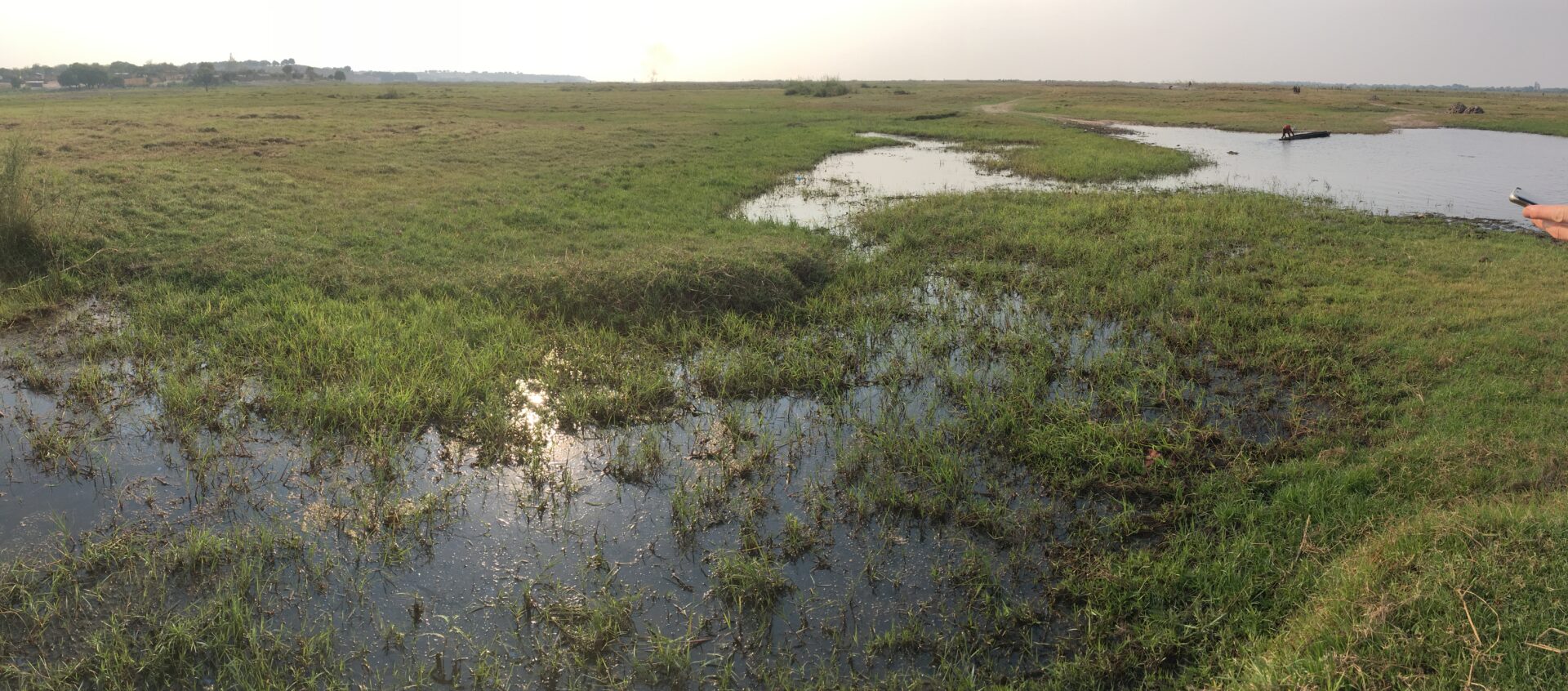
Surface water habitat on the Barotse floodplain, Zambia
Objectives
To achieve this vision, we have established the following primary objectives:
- Investigate and evaluate different remote sensing and model-based methods for high-resolution ET estimation, assessing their accuracy and efficacy across annual and seasonal scales in the region.
- Perform field campaigns to obtain in-situ measurements of ET across diverse landscape types within the study area, addressing critical observational data gaps and ground-truthing satellite estimates.
- Supply validated, high-resolution ET estimates into 2D hydrodynamic models to evaluate the sensitivity of surface water dynamics and village-scale malaria suitability to realistic water losses.
- Examine the response of ET and surface water persistence to projected climate change under various future emission scenarios, informing long-term national malaria elimination strategies.
Fit to NERC Science
This project is aligned to the NERC ‘Terrestrial and freshwater environments’, ‘Geosciences’ and ‘Climate & climate change’ research areas. Specifically, the project aligns to the following NERC research areas: (1) Hydrological processes / Earth surface processes – by modelling fluvial hydro-dynamics across Africa; (2) Ecosystem scale processes – by evaluating the impact of flooding on mosquito larval habitats across entire landscapes; (3) Climate and climate change – by predicting changes in malaria hydro-climatic suitability between the present day and 2100.
Potential for high impact outcome
The accurate ET estimates in data-scarce region is a long-standing research domain and their coupling with hydrodynamic models with more conventional thermal response curves is an emerging focus of research (see our recent paper in Science: Smith et al., 2024). This area of research bridges disciplines and scales and has a clear global impact. The project will produce several outputs including: (i) 3-4 academic publications, at least one of which we anticipate being suitable for submission to a high-impact journal; and (ii) presenting relevant study outputs to the malaria control programme of Zambia where the project team have a previous track record of establishing links of communication.
Training
The successful student will work under the supervision of Prof Mark Smith and Dr Lalit Pal (School of Geography, Uni. of Leeds) and Prof. Mark Trigg (School of Civil Engineering). The successful candidate will develop a range of research skills including GIS and Remote Sensing, hydraulic modelling, python scripting, statistical analysis, data presentation, academic writing skills and giving presentations. It is anticipated that some field work may be useful to help ground-truth the model predictions. Training will be provided in field health and safety procedures.
The student will be supported throughout the studentship by a comprehensive PGR skills training programme that follows the VITAE Research Development Framework and focuses on knowledge and intellectual abilities; personal effectiveness; research governance and organisation; and engagement, influence and impact. Training needs will be assessed at the beginning of the project and at key stages throughout the project and the student will be encouraged to participate in the numerous training and development course that are run within the NERC DTP and the University of Leeds to support PGR students, including statistics training (e.g. R, SPSS), academic writing skills, grant writing etc. (http://www.emeskillstraining.leeds.ac.uk/). Supervision will involve regular meetings between supervisors and further support of a research support group.
Student profile
The student should have a keen interest in environmental issues with a strong background in a physical geography, earth sciences, environmental sciences, ecology or related discipline. Strong GIS/remote sensing/statistical/fieldwork and survey skills are desirable but not essential, as training will be provided during the PhD.
References
Smith, M.W., Mark Graham Macklin, and Christopher James Thomas. “Hydrological and geomorphological controls of malaria transmission.” Earth-Science Reviews 116 (2013): 109-127.
Caminade, Cyril, et al. “Impact of climate change on global malaria distribution.” Proceedings of the National Academy of Sciences 111.9 (2014): 3286-3291.
Ryan, Sadie J., Catherine A. Lippi, and Fernanda Zermoglio. “Shifting transmission risk for malaria in Africa with climate change: a framework for planning and intervention.” Malaria Journal 19.1 (2020): 170.
Smith, Mark W., et al. “Future malaria environmental suitability in Africa is sensitive to hydrology.” Science 384.6696 (2024): 697-703.
Godara, Nitesh, Oddbjørn Bruland, and Knut Alfredsen. “Comparison of two hydrodynamic models for their rain-on-grid technique to simulate flash floods in steep catchment.” Frontiers in Water 6 (2024): 1384205.
Taheri, Mercedeh, et al. “Developing a dynamic semi-distributed hydrological model considering interactions between soil moisture and evapotranspiration: application of bulk transfer method.” Hydrological Sciences Journal 68.2 (2023): 228-245.
Tanaka, Tomohiro, et al. “An integrated hydrological-hydraulic model for simulating surface water flows of a shallow lake surrounded by large floodplains.” Water 10.9 (2018): 1213.
Weerasinghe, Imeshi, et al. “Can we trust remote sensing evapotranspiration products over Africa?.” Hydrology and Earth System Sciences 24.3 (2020): 1565-1586.
von der Heyden, Constantin J., and Mark G. New. “The role of a dambo in the hydrology of a catchment and the river network downstream.” Hydrology and Earth System Sciences 7.3 (2003): 339-357.
Willis, T. D. M., et al. “Hydrodynamic modeling of inundation patterns of a large African floodplain indicates sensitivity to waterway restoration.” Water Resources Research 58.11 (2022): e2021WR030107.